Virtually every telecommunication and utility company we work with today are taking on digital transformation initiatives of some kind. Some of these are very broad, involving the entire enterprise and others are much more focus, perhaps focused on one department or critical workflow. One common success factor that stands out with all these initiatives is having mobile capabilities that support and enable a fully digital operation. Mobile applications that are easy to use by your field teams and are tightly integrated with other systems, including your Geographic Information System (GIS), are fundamental to driving successful digital transformation and realizing the benefits it brings.
Questions to ask geospatial software vendors
Because mobile-first geospatial software is so critical to your digital success, it’s important to ask potential vendors the right questions about their mobile capabilities. You cannot assume that just because you have a GIS in your telecoms or utility office that it can be successfully extended into field operations. This is illustrated by the fact that many of the major GIS vendors have very different architectures for their office and mobile solutions. They often rely on third party products or delivering SDK’s that force companies to create, deploy and support their own mobile solutions on proprietary platforms.
RFP template for telecoms and utility companies evaluating mobile solutions
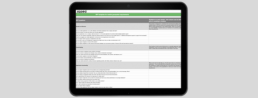
Most RFP and RFI’s we see from telecoms and utility companies set the bar far too low. Their structure of their RFPs maps out “good enough” mobile software that will not provide their field teams the solutions they need now and into the future. We want to help you set the bar higher. With 170 detailed questions and supporting notes, IQGeo has produced an RFP template in an Excel format that will help you think through the various components of a successful mobile geospatial solution. It is designed to help you align RFP questions with your strategic goals in order to choose a long-term partner who understands your business challenges and delivers solutions to solve them.
Below is a summary of the key sections and a sample of the questions you should be asking vendors in your evaluation.
System architecture
This section is designed to understand the fundamental building blocks of the mobile solution, and the devices and operating systems that are supported. With the rapid development in the mobile market, driven by consumer demand, you need flexibility to rapidly adapt your hardware and operating systems for future requirements.
- Can your mobile application run on iOS, Windows and Android seamlessly from a single code base?
- Can your solution run online and offline from the same application?
- How do you upgrade your mobile application, do they have to be brought back into the office?
Cloud hosting
Cloud hosting of critical system infrastructure is a desirable deployment option for many organizations. It provides the ability to scale IT resources up and down with demand, reduce capital and operational costs and support rigorous compliance, security, and resilience standards. Even if you’re not planning a cloud deployment today, it’s still critical to select a solution with an architecture that is cloud ready for the future.
- Can your solution be deployed serverlessly?
- Does your solution work with cloud managed services like hosted databases, file systems, load balancers, etc?
- Can your solution scale automatically, according to demand?
- Does your solution work with a variety of low-cost operating systems, like Fedora, Ubuntu, Amazon Linux, etc?
Application functionality
What is the basic functionality you should expect from an enterprise mobile application? Any functionality that a proposed solution does not have from the questions in this section should lead you to ask about the maturity of the product, or the power of the application to meet your current and ongoing requirements.
- Do you support map rotation?
- Can you display basemap data from providers including Google, Bing, Here, and OpenStreetMap?
- Can you take basemaps offline?
- Can you display Google Street View data? Can you overlay asset data in Street View and select it?
- Can I edit the attributes and geometry of existing assets?
Configuration, customization and administration
This section explores the critical features that should allow you to deploy a system rapidly to the field and control the total cost of ownership.
- Do you support configuration of different aspects of the application using a simple graphical user interface?
- Are customizations automatically synced to all mobile devices?
- Do you support Active Directory / LDAP? How do I add and remove new users and define roles?
Product development and testing
These questions are often forgotten but can quickly help you assess the maturity of the software vendor. It will help you establish if they are using all the modern tools available to deliver rock solid products.
- Describe your internal testing procedures?
- How do you support customer development, test and production environments?
- How are updates moved between environments?
- Describe your use of open source software.
Production support
In this section you’ll find pragmatic questions about the supporting infrastructure required to roll out a solution and what has the software vendor deployed previously. While it is good to be on the leading edge, it is not advisable to be on the bleeding edge! When asking scalability questions, it’s wise to anticipate significant deployment grow to support many more employees and contractors.
- Describe your standard support offering including escalation process.
- Describe the largest deployments by number of users for both online only and offline solutions.
- What performance monitoring do you support to ensure that the system continues to perform at the optimal level across our enterprise?
Services
All mature, proven service organizations have standardized methodologies for deploying their solutions. This section allows you to determine the structure of those methodologies and if they fit with your organization’s best-practice standards.
- Describe the breadth of services that you support including project management, implementation, testing and customization.
- Describe your implementation methodology and its advantages.
- Do you support customizations that you develop for your customers?
Software licensing
It is important to understand how vendors license their software as this will define your Total Cost of Ownership (TCO). For example, subscription-based pricing models are increasingly common for enterprise software, it’s essential to get a view on how mobile devices are licensed, and if there are options for dynamic license expansion when required for responding to natural disasters. All these licensing issues will impact your own TCO calculations.
- Describe the different methods you have for software licensing.
- How do you support storm events where we may need many more licenses for a short period of time?
- How do you license a user that may have multiple devices (laptop, phone, tablet etc)?
Data integration
A key component of your field solution is taking data locked in office silos and delivering it to the field in a digestible format. Any mobile solution fit for deployment should have multiple methods of integration and many example systems.
- Does your system integrate to all common GIS systems including Esri, GE Smallworld, Hexagon, Bentley & AutoCAD?
- Can I integrate multiple different GIS systems into your platform at the same time?
- Do you support any of the following basemaps – Google, OSM, Bing, Here?
Offline data architecture
Regardless of the connectivity in your region, you must have a solution that works both online and offline. This becomes a must in storm or emergency situations and almost every utility and telecoms operator will have dead spots where it’s critical to be able to work seamlessly offline.
- Does your application support incremental data sync to and from mobile devices?
- Does your mobile application automatically sync when a network connection is available?
- How does your system manage a mobile client sync that fails?
Security
You will probably have an established security questionnaire already but here are a few questions just in case you want to keep it simple.
- Do you develop your product according to industry best practices for security? Specify the practices that you follow.
- Do you support the use of MDM (mobile data management) and MAM (mobile asset management) systems to provide security features such as remote data wipe and encryption?
- Can you switch between authorized users on a mobile device, using common offline data?
- Is two factor authentication (2FA) critical for mobile tools used by internal staff and external contractors?
Version and design management
If you are going to use your application to capture data in the field, this section helps you understand the vendors capability for managing designs and updates. The ability to coordinate field activities between crews in the field dramatically improves productivity.
- Does your mobile product support version managed data, online and offline?
- Can you switch between versions on the mobile application, online or offline?
- Can you create new versions on the mobile application, online or offline?
Applications
If you have established that the platform meets your requirements, this section explores if there are a set of business focused tools that you can plug in to expand the usability of the solution. Having a single platform and interface for multiple applications helps avoid application fatigue – having to use many different apps to complete a task.
- Are there a set of business focused applications that run on top of your mobile platform, provide by you or third parties? If so, describe the capabilities of these applications?
- Can the capabilities of multiple applications be provided within a single environment, so users do not have to switch between multiple apps on the mobile device?
- Can custom functionality that we have developed be easily integrated into any application and be upgraded?
Network management
This section explores if there are a set of fiber network management focused tools that you can plug in to expand the usability of the solution.
- Does your solution provide online or offline view, report and edit splicing and patching capability?
- Do you have out of the box reports for common fiber items such as a bill of materials, ISP equipment port availability or connectivity?
- Does your solution allow field technicians to trace fibers, locate OTDR reflection points and produce on the fly splicing and patch schematics?
Workflow management
This section explores if there are a set of workflow management focused tools that you can plug in to expand the usability of the solution.
- Can your system create projects and tickets to manage workflows?
- Can configurable forms be assigned to the ticket workflow?
- Can mobile users update the status of projects and tickets and share that information?
Free mobile geospatial RFP template
Whether your organisation is new to purchasing a mobile geospatial solution or you're looking to switch from your existing provider, this mobile geospatial RFP template will help to ensure you ask the most important questions. We hope you find this a useful resource in selecting the right solution and partner that fits your unique requirements and business goals.

This blog post was originally published on December 18th, 2019. Updated February 2, 2022
 Previous