Utility and telecom operators today manage networks that are more complex than ever. With the creation of smart grids and 5G, we are constructing some of the world’s most complex, distributed “machines” ever imagined. This means that operators are now forced to deal with numerous rich information systems across their enterprise, each with specialized tasks or applications that usually require highly skilled people to curate them. These include separate systems for managing customers, network assets, inventory, workforces, processes and many more. A Geographic Information System (GIS) is one of these many data resources, where the main “asset” is the geospatial position of a network record. In this way, GIS proponents often position it as a kind of information hub, because most data can be represented geographically in some way – via a coordinate, an address, or other spatial reference.
Going beyond GIS
All this technology is essential for managing our increasingly complex networks. However, it often creates a plethora of applications and “experts” with siloed information, leading to inefficient operations with often conflicting or out-of-date information. The search for consolidated access to disparate information is as old as information itself (the difference between data and knowledge). Geospatial technology finds itself in a privileged position by representing data in a uniquely compelling and powerful way, showing us the spatial relationship between previously disconnected information. At IQGeo, we believe in the power of geospatial technology, but it must go far beyond the concept of a centralized “enterprise GIS” solution. For any solution to be successful with today’s (and tomorrow’s) complex network requirements, it must be focused on the network itself, with all of its complex relationships and connectivity, not just the geospatial aspect of the network. The effective solution must flexibly integrate applications, data, and workflows into an easy-to-use “single shared geospatial interface” for all stakeholders across the organization.
“At IQGeo we believe in the power of geospatial technology, but it must go far beyond the concept of “enterprise GIS” as a centralized solution.”
The legacy GIS silo
While a GIS can be useful, it is still an information silo with its own set of specialist applications for accessing and representing information, as well as its own certified specialists essential for curation. The employees who need to access data often find themselves dependent on internal experts to update and access information using specialist applications that are built for different departments or processes. This orthodoxy simply no longer has a place and is compromising business success. Every day, telecommunication companies and electric and gas utilities are putting more technology at the edge of their networks, and software solutions must reflect this distributed reality by empowering stakeholders across the organization to view, analyze and contribute to the accuracy and quality of the network data. A distributed network demands an open-sourced approach that is focused on the network and not the applications.
But at the end of the day, it is the operational teams in the office and field that need an accurate and up-to-date network view to overcome their technical and business challenges. Since that data is one of the most expensive assets to acquire and maintain for any organization, it is critical that all stakeholders can access and enhance it quickly and easily for maximum benefit. To achieve this, the people using the systems cannot afford to be experts and must have a simple, single interface that provides a sophisticated and consolidated geospatial view of their network and application assets. Each team must be able to dynamically consult, analyze, correlate, and make decisions based on data from multiple sources simultaneously in a way that is relevant to your specific workflows. And since those workflows may not be known in advance, and will be different for each organization, the single network view must be easily configurable.
Finding Albert Einstein
An analogy to illustrate the point is using Google Maps in your private life. Today Google Maps (not Google the search engine) is often sufficient to navigate to the information you need using a map as the entry point, even if the information itself is not obviously geospatial.
Let’s say you want to learn about Albert Einstein, so you type “Albert Einstein” into Google Maps. Albert is clearly a person, not a place, so why start with Google Maps? You do this because of the wealth of information about Albert Einstein that can be found via a geographic starting point. Your search will present various results, starting with the location of his house, a museum about him, and restaurants and other businesses named after him. Then, with one additional click you can find a synopsis of his life on Wikipedia, see the location of his birthplace with Google Maps, display a list of each of his principal discoveries via an on-line encyclopedia, get his IQ from ZME Science, discover his wife’s name, learn about his university, and much more. You are experiencing Albert Einstein through a single geospatial view.
The vision of the IQGeo geospatial network view
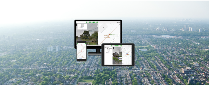
You need this kind of easy and intuitive access across your entire enterprise network data repository, and using the IQGeo software, our customers are creating a consolidated, single, accurate geospatial view of their network. If you type “critical customers” into the IQGeo search window, you could see a map with a collection of hospitals, airport control towers and other facilities that must be protected from electrical and communications network disruption, and which would be high priority for restoration if there is a network failure. Click on any one of these facilities and you see the equipment they have in operation, real-time data about resource consumption at those locations, details on their customer account, and how best to reroute a signal in the event of outage. Customer records are coming from a CRM, real-time consumption information from sensors, maintenance history on infrastructure from an ERP, circuit and circuit-rerouting possibilities from network management and OSS or BSS applications. All this with a simple, one-line search using your finger on a tablet or phone while working in the field.
“You are looking at all the data through a single pane of glass that allows you to intuitively browse the entire network machine.”
Some customer examples:
- Western Area Power Administration (WAPA). With IQGeo’s easy-to-use and efficient mobile field inspection solution, WAPA can effectively monitor transmission system health and enable the entire organization to use the same inspection criteria and rating system.
- TELUS. IQGeo enabled TELUS to reduce the number of applications the teams were using and provided field crews with an intuitive app with access to GIS data, consolidating their applications into a single, powerful geospatial view.
- Portland General Electric (PGE). PGE now has comprehensive situational awareness across teams during disaster response cases due to IQGeo’s collaborative approach to mobile network viewing and capture.
The IQGeo software pulls the data dynamically from a variety of sources without you even knowing. None of the underlying applications has a “home-field advantage,” and you don’t need to know how to query any of those systems individually. As with the other applications and data sources, your GIS is playing only a part in the overall picture that is being created. You are looking at all the data through a single pane of glass that allows you to intuitively browse the entire network. The integration between systems happens in the background, and relevant information is presented through an easy-to-use, Google-like interface.
Building better networks
Utility and telecommunications operators are “Building better networks” with IQGeo’s award-winning software solutions. The ability to powerfully model any network requirement, integrate every system and data source, and support field and office teams with continual innovation is helping operators create the networks of the future. Our solutions ensure greater cross-team collaboration and process efficiency throughout the network lifecycle, from planning and design to construction, operations, and sales.
It is time to give office and field stakeholders immediate and intuitive access to the information they need to do their jobs efficiently without requiring specialist data products or analyses provided on-request by siloed GIS gatekeepers. At IQGeo, we provide the tools and capabilities that allow telecom and utility operators to see their network in a single, powerful view. The business and operational benefits realized through this single pane of glass are clear for everyone to see.

This blog post was originally published on March 19th, 2021. Updated September 2, 2022
 Previous