Over the course of the last year I have visited more than 30 utility and telecom companies and probably spoken to an additional 30. I’m constantly astounded by how tolerant organizations are of inadequate and outdated geospatial solutions. My general conclusion is that utility and telecom companies have been plagued by what Tom Peters, author of The Excellence Dividend, calls “stagnation by mediocre success”.
As field teams upgrade from paper and Microsoft Excel, existing geospatial vendors have struggled to provide elegant platforms, instead saddling their customers with cumbersome and slow solutions. Yet companies seem happy to deliver these failing products to their users because they do provide some benefits over traditional manual methods. However, they are focused on providing a digital map to the field, not transforming the way field teams use geospatial data in the same way Google has transformed the use of geospatial data for consumers.
Geospatial platform challenges
From my experience, it is clear that utility and telecoms providers are today facing three critical geospatial platform challenges, which are going to drive major change across these industries.
- Poor usability
- Multiple software solutions for one business process
- Slow performance
1. Poor usability
Solutions are often too complex as they are ported office-based solutions and not designed specifically for field operations. There are so many highly usable mobile solutions widely used today, such as Google Maps, Yelp, LinkedIn, that there is a much higher expectation from field teams for excellent solutions. When the solution fails to deliver on these expectations, this leads to a lack of user acceptance and conflict between IT, operations and engineering. The result is often even less productivity than using an old fashion pencil and paper.
2. Multiple software solutions for one business process
Other common problems are solutions that are not powerful enough to digitize a single business process or cannot be easily customized and integrated to meet specific requirements. In this case, users are stuck jumping between applications with different interfaces and probably paper in order to complete a task. This causes errors, frustration and data gaps that reduce the speed and accuracy of decision making and proliferate ongoing data rot. This is often amplified when back in the office as yet more software architectures lead to yet more data transfer and repetition.
3. Slow performance
Field users need excellent performance from applications to avoid interrupting their standard work flow. Lack of responsiveness encourages field personnel to develop work-arounds to get the job done. Often these don’t follow standards, causing knock-on effects to downstream processes and increase operational risk. The challenge now is the that the mobile applications in use outside of the office not only have great user experiences but excellent performance rightly increasing user expectations.
Industry challenges
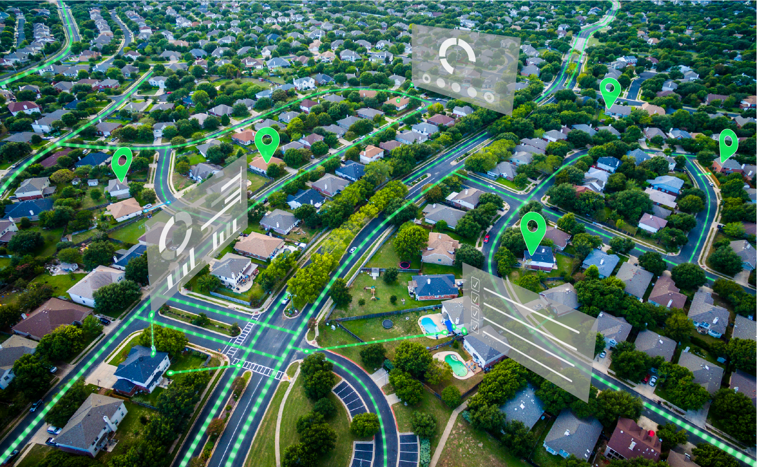
The utility industry is facing unprecedented change with DER, IoT, extreme weather and greater regulatory oversight, dramatically increasing pressure to optimize daily operational processes. Telecommunications companies are constantly competing with new technologies, increasing competition, greater consumer choice and higher service expectations. Companies should not be satisfied with substandard geospatial platforms for their field or office teams that actually hold back corporate digital transformation ambitions.
Next generation of geospatial platform
Fortunately, for telecom and utility professionals, new geospatial architectures are emerging that are designed specifically for their industries and will help them to overcome the inherent weaknesses of legacy GIS and fragmented mobile platforms. When evaluating these solutions there are four key areas that should be examined closely.
- Single common software architecture from field to office
- Mobile first development
- Cloud ready
- Integration focus
1. Single common software architecture from field to office
There should be no need to develop applications multiple times for different devices and operating systems. Applications and updates need to be rolled out rapidly and effectively across the company and a single common geospatial software architecture is critical to bridging the data and process gap between the office and the field. This dramatically reduces deployment costs and ongoing cost of ownership for internal IT and DevOps teams.
2. Mobile first development
With the dramatic increase in the availability of sophisticated and usable mobile technology, more and more data capture will happen in the field. This “capture at the edge” can only be enabled effectively if applications are written specifically for mobile devices, and not adapted from workstation configurations. Forward looking geospatial solutions must have a “mobile-first” development philosophy to enable this new capture at the edge philosophy.
3. Cloud ready
The question is not if, but when your geospatial platform is going to be running in the cloud. Spending millions of dollars to upgrade a geospatial system that relies on thick clients and legacy architectures isn’t the answer. A traditional GIS architecture will never be fully cloud ready, significantly inhibiting the future evolution of your business.
4. Integration focus
No geospatial platform is an island. They are an intrinsic part of daily operations for utility and telecom companies. To be a truly effective organizational tool, they must ingest data from many different sources and be simple to integrate with other business critical systems such as WMS, NMS, ERP, CIS, ADMS etc. The ability to quickly integrate other applications and processes accelerates business work flow, not just in the field but across an entire organization. Traditional GIS solutions such as Esri talk about openness and integration but are very happy to subtly lock your data into their architectural silo and force you only develop on their platform or one of their handcuffed partners.
Summary
While the complexities of the utility and telecom industries creates real challenges to optimizing and integrating field and office processes, there are now proven alternatives to the legacy GIS approach. New end-to-end geospatial platforms must be considered especially when evaluating expensive upgrades to existing systems. Regardless of the platforms adopted, it is time for companies to stop being satisfied with mediocre success and demand more from all their geospatial vendors.
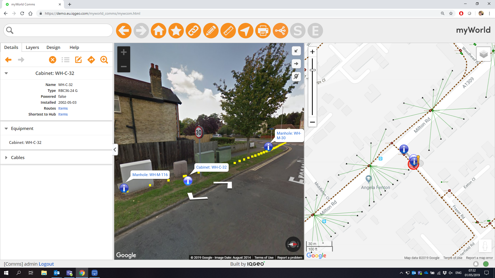
IQGeo has recently announced a transformative next generation end-to-end geospatial platform based on our industry proven myWorld* platform. Our new platform goes far beyond traditional GIS solutions, delivering a step-change in productivity and collaboration for telecom and utility network operations.
Visit our website for more information on the IQGeo Platform.
*myWorld is now the IQGeo Platform
The 6.0 release of our software included a product name change from myWorld to the IQGeo Platform. This change reflects our focus on the IQGeo corporate brand that was launched at the beginning of 2019. Our website and latest product user interface have made the transition from the old myWorld name to the new IQGeo Platform name. Learn more about the IQGeo Platform 6.0 release.
 Previous