
Jason Tripp considers the top three criteria that should be used to evaluate your geospatial platform, as a mission-critical factor in your digital transformation strategy.
Digital transformation is being embraced by many of our customers across the utilities and telecommunications industries, and they’re not alone. In a recent survey by Deloitte, 95% of power sector respondents agreed with the statement “Digital transformation is a top strategic priority at my organization”.
Critical to the success of any digital strategy is having the enterprise data systems in place to support and enable the process. For businesses where the physical network infrastructure is fundamental, as it is for utilities and telecoms, the geospatial platform is mission-critical and arguably the most important system.

So how do you know if your geospatial platform is fit for purpose and able to support your journey to digital transformation?
When making any diagnosis, you need a well-defined set of criteria. For geospatial platforms the three most important areas to evaluate are:
- Usability
- Speed
- Scalability
Usability
IT Managers will often be asked "Why can't our GIS be as easy to use as Google Maps on an iPhone?"
And it’s a good question. As consumers we have become used to the intuitive user interface offered by Google Maps and its simplicity is now the benchmark for the usability of any mobile geospatial application. Google Maps is the most used mapping application by a wide margin and is the eighth most downloaded application in 2018 (according to Apple).
One of the top reasons people love Google Maps is its simple interface, clear directions and preferred features. The ability to run on any standard mobile smartphone, any browser and the use of a one box search with voice activation, all contributes to the popularity of Google Maps.
Google Street View has been a game changer for accessing clear directions and providing a reality-centric view for users. And this is not just for consumers but across businesses too. For network infrastructure providers, leveraging Google Street View for annotating infrastructure information is increasing field productivity. Small features, such as selecting information compared to typing information, can make big improvements to the usability of an application.
Speed
One of the driving forces for digital transformation is increasing the speed at which things can get done. Field employees should be able to quickly access geospatial information regardless of connectivity. The longer it takes to render and access geospatial information, the greater risk you have of field employees complaining and missing crucial customer service KPI's because they are forced to revert to pen and paper.
Database technology that precaches your tile store accelerates the speed at which information is rendered on the screen. It’s no longer necessary to make a manual GIS database inquiry each time you need to look something up. Speeding up business processes can lead to happier and more productive employees, but it also delivers further benefits across operations, including:
- Lower asset replacement and construction costs
- Improved reliability statistics
- Enable faster response times to improve customer satisfaction
Scalability
Scalability has traditionally been viewed as the ability to easily shift resources up or down depending on need, without negatively impacting performance. Consumer grade smartphones have emerged as reliable, safe and economical options and have changed the balance of computing power. Shifting processing power such as taking pictures, collecting and analyzing information is also known as edge data capture or Fog computing.
It’s now important to ask the question: ‘Do you have the ability to shift computing needs to end user smartphones at the edge of the network, online and offline’? Reducing data volumes that are constantly being sent to the cloud lowers costs, improves performance and frees up much needed back-end computational resources.
Geospatial platform for digital transformation
Having the right geospatial platform in place is vital to the success of any digital transformation strategy. The three critical areas outlined in this blog provide a framework to consider whether your current system is fit for purpose and are able to deliver on your business objectives, both today and in the future.
The truth is that many network infrastructure providers are using geospatial platforms that aren’t just impeding the progress of digital transformation but, through their inability to provide a timely view of network assets, are creating massive operational inefficiencies and dramatically increasing corporate risk.
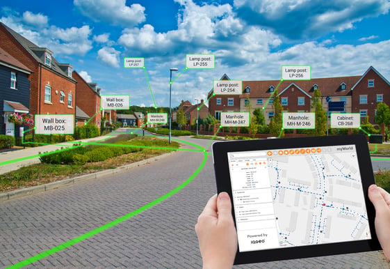
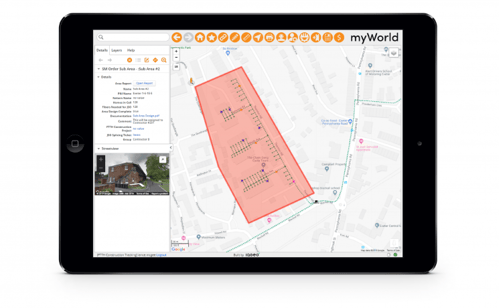
IQGeo offers an innovative reality-centric approach that enables infrastructure companies to dramatically increase the quality and currency of their data, while reducing operating costs and risk. An integrated mobile first architecture, with smart applications, actually models the reality of the network using much simpler graphical representations. This streamlines processes and applications, removing inherent GIS update bottlenecks, and allows authorized staff to update network assets on any device, from anywhere.
Learn how IQGeo’s mobile-first next generation geospatial platform will transform your business.

 Previous